Mixed-Use
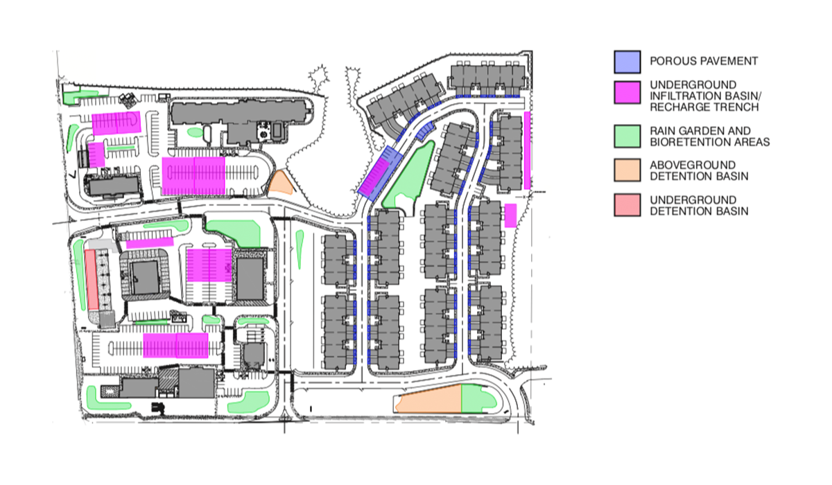
Before Rule Change:
This comparison shows a complex mixed-use development project. Although a previously developed property, the site has been vacant for some time, allowing successional trees and vegetation to establish throughout the site in the pre- developed condition. The site is at the intersection of two significant roadways. The other two sides of the property include a stream corridor and a large public park with additional public amenities. The stream corridor includes freshwater wetland features adjacent to the proposed development and a floodplain with a history of flood-related impacts downstream from the site.
The pre-developed conditions on this long-vacant site limits the rate and volume of stormwater runoff leaving the site. The adjacent wetlands are ecologically sensitive, and the floodplain is vulnerable to additional runoff due to existing downstream flooding issues. Therefore, the applicant, design team, municipal professionals, and NJDEP all knew stormwater management would be al significant issue during the development application review process. Anticipating stormwater design based primarily on decentralized green infrastructure was prepared. The approach was not required at the time, as the rule would not be officially adopted until after the project was approved.
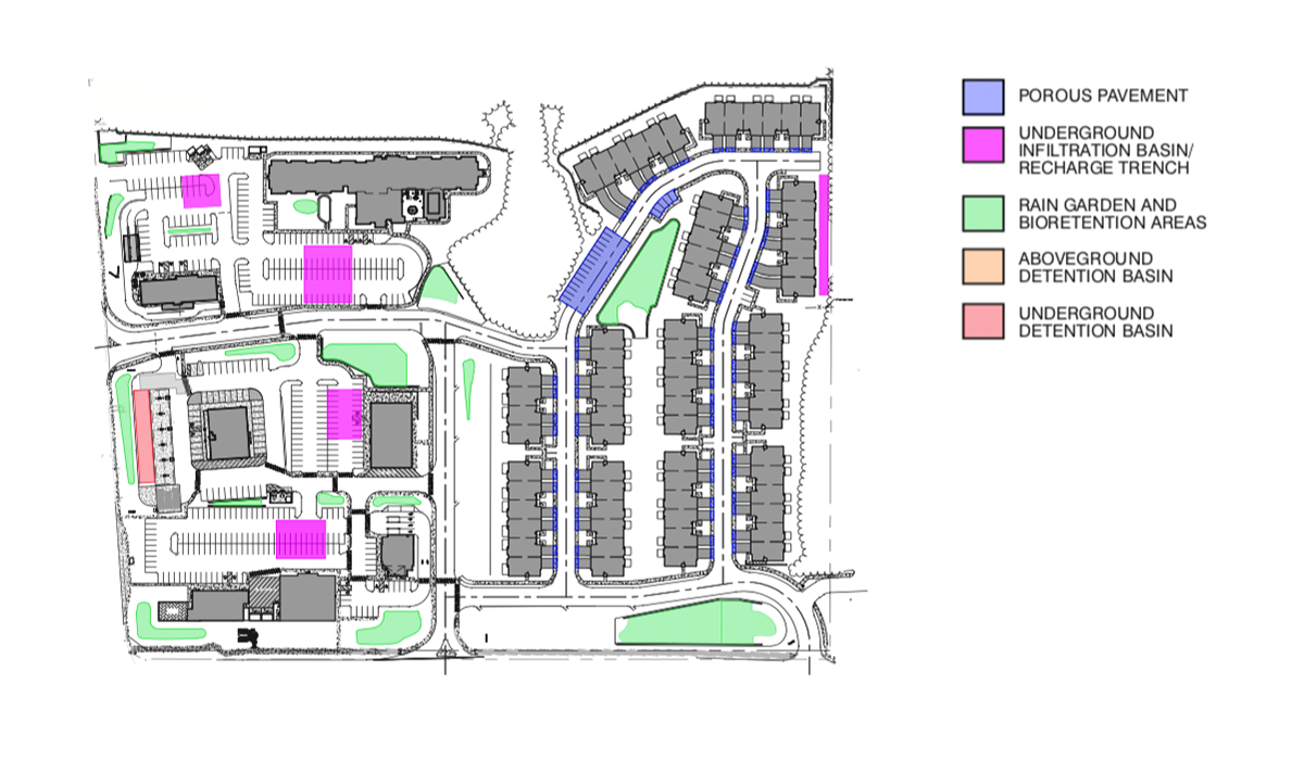
After Rule Change:
This project presents a unique opportunity to compare a decentralized green infrastructure stormwater management design before and after the rule adoption. It demonstrates how key changes to the BMP Manual guidelines, specifically the ability to “count” infiltration in the design and routing of the stormwater management facilities, have an enormous impact on cost considerations. The updated BMP Manual requires specific geotechnical exploration, soil testing, and groundwater mounding analysis in order to verify the extent to which infiltration can be counted. In this case, the soils and depth to seasonal highwater table were very favorable. The decentralized nature of the stormwater management design acts to reduce the potential for groundwater mounding and associated adverse effects. As a result, under the new stormwater rules and associated BMP Manual, the underground infiltration portions of the stormwater management system can be reduced in size by 30% to 40%.
Compare the purple-shaded portions of the rendering above with the portions of the rendering on the left to see how much smaller and less costly the underground infiltration becomes after the rule is in place. Note also that none of the surface bioretention systems are reduced in size. Under the new rule and BMP Manual, the decentralized BMPs are recognized and fully credited for effectively managing stormwater. Furthermore, the site design uses green infrastructure features to enhance pedestrian mobility, access to public transit, and linkage to the adjacent public facilities, reflecting a holistic approach to land development that benefits the property owner, tenants, and community.